Construction Surveying
Manage your sites efficiently by capturing high quality datafor accurate maps, orthomosaics and 3D models.
Manage your sites efficiently by capturing high quality data
for accurate maps, orthomosaics and 3D models.
How Drones Facilitate Construction Projects

Streamline Planning
Improve your planning and bid process with rapid, accurate, and cost-effective drone data

Optimize Project Management
Eliminate project waste with full-site awareness using regular, shareable site maps

Reduce Risk
Track every step of the construction process for years – even across multiple owners
Industry Leading Products
Regardless of the task at hand, Cloud City Drones provides a complete lineup of the highest rated industry tools to help get the job done.

MATRICE 350 RTK
The Matrice 350 RTK is a DJI commercial drone platform that takes inspiration from modern aviation systems. Offering up to 55 minutes of flight time, advanced AI capabilities, 6 Directional Sensing & Positioning, and more, the M350 RTK sets a whole new standard by combining intelligence with high-performance and unrivaled reliability.

MAVIC 3 ENTERPRISE SERIES
The Mavic 3 Enterprise Series redefines industry standards for small commercial drones. With a mechanical shutter, a 56× zoom camera, and an RTK module for centimeter-level precision, the Mavic 3E brings mapping and mission efficiency to new heights. A thermal version is available for firefighting, search and rescue, inspection, and night operations.

Zenmuse H30 Series
A powerful, integrated payload that unleashes advanced intelligent capabilities for DJI’s industrial drone platforms.

Zenmuse L2
The Zenmuse L2 integrates a Livox Lidar module, a high-accuracy IMU, and a camera with a 1-inch CMOS on a 3-axis stabilized gimbal.
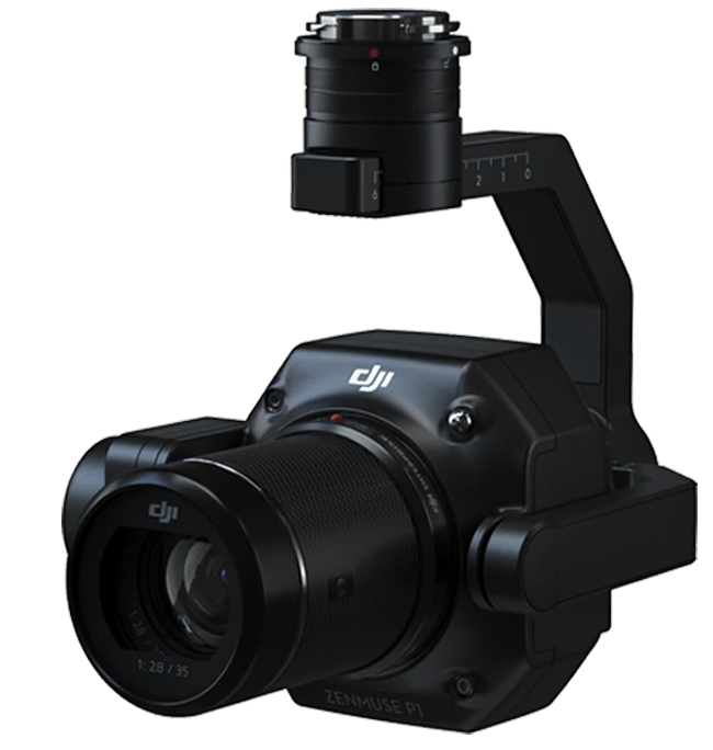
Zenmuse P1
Verify data quality immediately post-flight by checking the position data and number of the images acquired, as well as RTK status and positioning accuracy.

Applications

Planning
Every construction project begins at ground zero. Drone technology makes data collection faster, easier, and more cost-effective – providing your business with a competitive edge from as early as the bidding process.
- Drone solutions map large work sites to provide detailed, precise data for architects and contractors. With flight planning and 3D modeling software, project teams can easily and rapidly collect the surveying data needed to evaluate large worksites.

Construction
Construction projects are complex, involving multiple sub-contractors, hundreds of workers, several years and millions of dollars to complete a single project. Drone technology provides regular, detailed maps of a site to align internal and external stakeholders to ensure each
- Drone solutions provide project teams with enhanced on-site situational awareness. By using image stitching and 3D modeling software, teams stay fully informed on site progress and resource allocation – keeping projects on time and on track.

Inspection
Building inspections often require teams to implement manual, rope-access techniques which require walking across rooftops and scaffolding. DJI drone solutions provide teams with high definition 20-megapixel images that can be captured on a single flight for tasks requiring
- Drone solutions provide inspectors with accurate data and enhanced safety. With high quality aerial imaging and real-time video transmission, inspectors can evaluate buildings from the ground without putting themselves in harm’s way.